


As we all think about the Great Wagon Road, our minds automatically picture our ancestors traveling the road with their personal possessions to new lands. They were adventurous and heroic to move their families to unfamiliar territories. Each person had their own individual story that they experienced along the road. Many of these stories are now lost to the winds of time and will never be known. However; many committed themselves to writing down their important events while on the journey. When we locate a diary from this era, it is treated as a spectacular treasure. The present day researcher quickly turns the pages to learn and experience the Great Wagon Road for themselves. The lives that have been affected by this old road is unlimited. I believe it is still changing lives as we all research our ancestors and preserve our history. Welcome to the final segment of our Great Wagon Road adventure. This portion will concentrate on the individuals who made a great impact on the road in many different ways.

1607-1744
Abraham Wood in 1646 began trading with the Indians located in Virginia and led an exploring party into the wilderness known later as the area of the Great Wagon Road.
Henry Hudson, a dutch explorer, was among the group led by Abraham Wood.
Thomas Batte, was sent to explore the territory in 1671. He reached the Mississippi River and turned back.
John Lederer, a German physician explored the area as well during the years of 1669-1670.
The meeting of the Five Nations was held in 1722 and attended by Governor Sir William Keith of Pennsylvania and Governor William Burnet of New York. This meeting was to bring peace with several different tribes of Indians and the new settlers who were pondering the settlement in the “wilderness” of Virginia and North Carolina.
From 1717 to 1767, a total of 68,872 German and Swiss immigrants arrived in Pennsylvania due mainly to William Penn who first arrived in 1708.
Secretary James Logan complained about the multitude of immigrants on March 25, 1727 in a letter addressed to William Penn’s son in England.
1744-1774
Resentment grew from the newcomers and their vast numbers. The customs and languages were different and viewed upon in a negative manner as a majority. Many began to look elsewhere for new settlements and freedom. The Germans and Swiss began to venture down the Great Warrior’s Path. The path was no more than a clearing consisting of 3 to 4 feet wide.
In November, 1743, two Moravians began a journey down the Great Warrior’s Path which brought them 5 months later to Georgia. They were Leonard Schell and Robert Cussey, Schell’s diary gave explicit details about the trip.
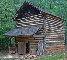
Joist Hite settled in Winchester, Virginia and owned an inn along the path that was widely known.
Stephen Schmidt settled along the Shenandoah River and owned a huge farm.
A diary excerpt from 1743 reads, “I used my hatchet to clear the path and fell a tree over Goose Creek in order to walk across it.”
Jacob Schuetz, an elder German, settled along Trent River, North Carolina after traveling down the road.
Stone marker lies in Winchester, Virginia stating that John Wilson and the bodies of his two children and his wife, Mary Marcus died and buried August 4, 1742.
Samuel Davies, minister, serving the southern portion of Virginia in 1759.
David McClure attended a wedding in 1775 in Virginia along the road and stated in his diary, “Dancing to the music of a fiddle, gambling and drinking.”
Joshua Fry, an Oxford graduate, moved to the frontier and worked as a surveyor of the road approx. 1757.
Peter Jefferson, traveled with Joshua Fry and had the task of map maker.
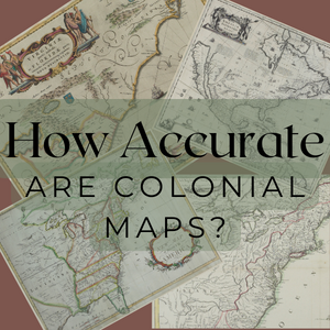
The 1st map was signed in 1744 and entitled, “Indian Road by the Treaty of Lancaster”
By, 1775 a new edition of the map was created and labeled, The Great Wagon Road from the Yadkin River through Virginia to Philadelphia, a distant 453 miles.
In 1744, a ferry was ordered on the Potomac, labeled Watkins’ Ferry. A ledger book contains ferry rates, blacksmith rates, lodging and the retail sales of wine and other commodities.
William Ingles operated a ferry across New River in Virginia.
John Mitchell, William Nesbit, William Montgomery, Archibald Craige, Thomas Bashford, James Bowers, John Verrell, Luke Dean, James Berry and Henry Hoah were all early merchants located in North Carolina during the years of 1750 and 1760 after traveling down the road.

The road became even more active with the end of the French War in 1763. The rumbles of the wagons could be heard all day along the road during this time. A house or a merchant could be found every 30 miles. Business soared, but mostly from trading versus monies. The road was divided as well with a lower road and a upper road. The lower road extended into Maryland and ran along the eastern side of the original road. The upper, ran just west of the original road and eventually led you to the new Wilderness Road. A family living along these roads, were able to prosper. This allowed many settlements, towns and new county seats to emerge.
The road was no longer a 48 inch path through the forest. It was now a major 18th century highway and was traveled each and every day of the year, weather permitting. However, King George III ordered in 1764 that no one was to settle west of the Appalachians. This was ordered to maintain peace with the Indians of that area. But, soon word spread that the best lands were west of the mountains and soon settlers began to venture even further.
When a family left Pennsylvania in 1765 and traveled on the road, they would meet other families traveling. They would have seen huge farms, forts, taverns and small villages lined with houses, small shops and churches. If you lived along the road, you were ordered to help maintain it. Farmers were employed in the fall and this was a great source of income that endured for years.
The term “public house” came into existence and these houses were widely known all along the road. They provided the traveler a hot meal and bedding for the night.
By 1774, everyone knew about the road and had experiences to tell and share. Portions of the original road still exist today such as Highways 11, 81 and 66. So, even today, the Great Warrior’s Path proves to be a vital link in our daily lives.

On a personal note, I want to Thank each of you for this experience and allowing me to share my research with you. I cannot express the gratitude I have for all of you in helping to preserve our history. As we move forward, I look to the future with great anticipation and working together on our history and ancestry. I could add so many more segments to this project and I most likely will in the future. I cannot forget to pass along admiration for all of the settlers who traveled the Great Wagon Road. Without them, none of this history would have existed.

Categories: Pennsylvania


Thanks for sharing this wonderful history.
LikeLiked by 1 person
Thank You for your kind words.
LikeLike
Thank you! A wonderful series!
LikeLiked by 1 person
Very well done! I’ve walked many segments of the road that is still in existence and often “feel” the souls of the travelers. A close friend of mine is one of the two area experts of the Road and he has shown me river foards, deep “cuts” still in existence and old graves along the Road. Of course many of these sites are in wooded, secluded areas where they have not been disturbed. Believe me, they’re still there. You just have to research and find them. To me it’s a pilgrimage.
LikeLiked by 2 people
Would like to know more about William Nesbitt. My 6th Great-grandmother, Mary Nesbitt, Franklin County, Pennsylvania, 1742-1795, was mother of my Revolutionary War patriot, James McKee, who served with Kentucky County, Virginia Militia under George Rogers Clark.
LikeLiked by 1 person
I, too, would love to learn more about William Nesbit and his ancestry.. May-be, this will be a future research project for me in the near future.
LikeLike
A very good read, as I reside in Central Pennsylvania, where the Monocacy Trail went from eastern PA and south south-westwardly thru places like Lancaster & York Counties, PA – into Maryland and its terminus near Frederick, MD. Understand it was just west of Frederick where The Great Wagon Road picked up (correct me if not accurate), and many persons, of which Moravians – traveled this thoroughfare from Bethlehem, PA and arrived at Wachovia – now Winston-Salem NC. Thanks for your post!
LikeLiked by 1 person
Thank You so much for the kind words. The Great Wagon Road had to have been A Great Adventure.
LikeLike
Very interesting blog. I’m going to try and find a Mary Marcus in my tree. Maybe she is an ancestor. I especially love the stories about individuals.
LikeLiked by 2 people
Thank You so much for your compliment. I wish you well with your research.
LikeLiked by 1 person
Thank you so much for your wonderfully entertaining and informative blog. I was very excited to see my 7x great grandfather’s name mentioned. Archibald Craige. I have just returned from a 12 day genealogy trip attempting to track down additional clues regarding his origins prior to setting in NC. He is still relatively a mysterious man although a large land owner with several businesses. Perhaps the answers are waiting for me in the Moravian records. Thanks so much for the information and inspiration!!
LikeLiked by 2 people
Carolyn, Thank You so much for your kind words !! I greatly appreciate them. I wish you great success with your research. Please, let me know if I can help in any way. Thanks-Carol
LikeLiked by 1 person
Carol,
Was wondering if you know of any good contemporary maps that have an accurate representation of the GWR (in its various iterations) shown on it?
I am trying to find the final resting place of an ancestor of mine and his wife who lie somewhere near Pulaski, Virginia … they travelled down the GWR in the 1780 to 1791 period … yep, a couple of those pesky Swiss/German refugees you mention …
Steve Flora.
LikeLiked by 1 person
Google NewBern, VA. NewBern was an hamlet established on the Wilderness Road. This path, later widened for wagons, was also called the Wagon Road, Great Road, Great Wagon Road, Road to Kentucky, etc. The Great Philadelphia Wagon Road segment turned south at Big Lick (Roanoke) and ended at today’s Augusta, GA area. Several trails branched out from there, even one that traversed across GA, AL, Miss and ended in the New Orleans area. All were originally Indian trails. Newbern, today, has several OLD cabins, barns, etc. from the colonial era. I’m pretty sure a museum is located there, and I’m sure their staff may be of assistance. Newbern is close to the Pulaski area. They may have a list of the early colonists who settled in that area and where. GOOD LUCK!!!
LikeLiked by 1 person
Several small trails broke away from the Great Wagon Road trail after 1765. I am currently working on the locations of these smaller trails.
LikeLike
I would suggest the Moravian Archives in Winston-Salem and also the NC State Archives in Raleigh.
LikeLiked by 1 person
I might add, the Moravian Archives in Bethlehem PA also could be a source as its counterpart at W-S NC
LikeLiked by 1 person
Here’s a link to a pdf on the Mann family the traveled to road from Lancaster south:
Click to access Jacob_Mann_Jr_born_1745_a_Early_Pioneer_of_Monroe_County_West_Virginia.pdf
LikeLiked by 1 person
Carol, I’m new to the podcast and blog. I am enjoying working through them chronologically. In the 18 January 2018 blog you mentioned the Leonard Schell diary. Do you know how I might find that diary? Is it online?
Also, can you recommend a map, if it exists, for 1790’s wagon trails from the Piedmont into East Tennessee. My Quaker ancestors left southern Guilford County for Jefferson County, TN.
Thanks,
Steve King
sumajman@gmail.com
LikeLiked by 1 person
Hi Steve, Thank you for visiting Piedmont Trails. The diary of Leonard Schell can be located at the Moravian Archives northern division in Bethlehem, Pennsylvania. Over the years, small portions of the diary have been transcribed and can be located sporadically on different sites online. As to the map, I suggest Henry Mouzon’s version dated 1794. You can view this map online at the Library of Congress website. Use the search tab on the site to specify the topic, maps and location, North Carolina. From this point you can select the date, 1790-1799 and search for Mouzon map for 1794. I have also created several videos on the early roads leading into Tennessee and Kentucky. By 1790, many routes existed traveling through the Blue Ridge and I have described these in detail on several “Live from the Attic” videos. You can find those on our YouTube channel.
Thank You so much for your questions and I hope you enjoy your journey to the past !!
LikeLiked by 1 person